30
2017Franz Josef Land: Getting close to the North Pole
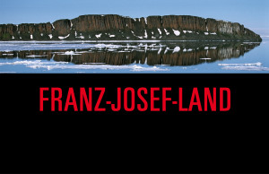
It´s been over a year since my last entry here. Franz Josef Land is also an old series, still taken on slides, from a trip in July 2004.
The tour started and ended in Kirkenes in Norway, from there we boarded the Russian icebreaker. Nowadays most tours leave from Murmansk. Tours going to the North Pole usually will also stop there shortly.
Franz Josef Land belongs to Russia, but you need no visa to go there. At the time of this tour the islands were reopened for tourism only a few years ago. When ist got busier, between 2011 and 2016 around 5500 people visited the archipelago.
The icebreaker is necessary to reach Franz Josef Land. In July 2004 there was so much ice that zodiacs could not be used to land on the island, we always had to go by helicopter, usually twice a day. But with global warming and the melting of the artic ice, I wonder how much it has changed in the meantime, if you still can see the icescapes show on the pictures here. Sometime in the future probably an icebreaker isn´t needed anymore and ship like those around Antarctica will do it.
It´s an amazing experience to travel on an icebreaker. The always changing scenery of ice and fog, the sound of moving through the ice in the otherwise silence of the remoteness, this is something you won´t hear and see somewhere else. And of course the sun not only doesn´t set at all, the light is only very slightly different at “night” and “day”. Just look at the picture of the two polar bears.
If you want to read about the discovery of Franz Josef Land try the novel “Die Schrecken des Eises und der Finsternis” by Christoph Ransmayr.
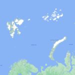
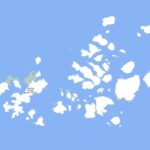
You can find its location here: Franz-Josef-Land.
02
2016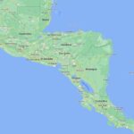 Central America: Mexico, Guatemala, Nicaragua, Costa Rica
This is a selection of pictures from two trips to Central America: In 2003 to Mexico, at that time I still worked with slides. Then in 2014/15 to the countries of Guatemala, Honduras, Nicaragua and Costa Rica. I also visited Honduras, pictures from there you might find in one of the other photo series from other portfolio categories than “around the world”.
You can see here photos from cities and locations: In Mexico: Puebla, Mexico City, Palenque, Uxmal. In Guatemala: Guatemala City, Antigua, Tikal. In Nicaragua: Leon, Granada, Masaya volcano area, Telica volcano area, Deer Island (which is also named Isla del Venado), San Jorge, Ometepe. In Costa Rica: San Jose and Manuel Antonio National Park.
10
2015Greenland in Summer
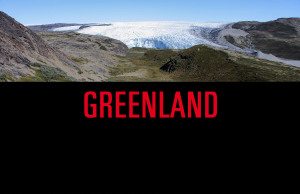
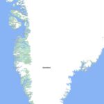
In the summer of 2009 I went to Greenland. After my trip to Franz Josef Land it was the second time for me to reach the arctic region.
And these are the very first pictures I took with a digital camera, a Canon EOS 5D Mark II, I got the camera just in time for this trip. And already on the second day it got a few scratches when I had to escape on a rock to escape the attack of a musk ox.
It was a summer camping trip. Greenland is a perfect country for camping, at least in summer. And it´s a place to really catch the sun. You just need to somewhat like mosquitoes, otherwise the fun will be reduced. The colors you can see are amazing. All the photos here show the original colors. I visited Kangerlussuaq, Sisimiut, Illulissat and places around the Disco Bay, easily accessible locations.
09
2015100 Countries Visited
In October I went to San Marino. Now I´ve been to 100 countries.
18
2015Vietnam and Cambodia in 1993
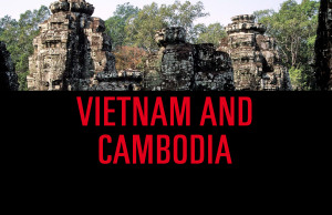
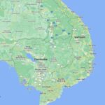
In 1993 I visited the southern part of Vietnam and some of Cambodia. My trip took me to Saigon (Sai Gon, Ho Chi Minh City), the tunnels from the war in Cu Chi, and south from there: Can Tho, Soc Trang, Vung Tau, including a wonderful boat trip on the river Mekong. Food at the seaside was amazing. After that I have not been there. Everywhere, Saigon then and Ho Chi Minh City now must be very different places. At that time it was a little adventure to go there without an organized tour.
Then in Cambodia the capital Phnom Penh and Siem Reap with Angkor. There were very few tourists in Angkor at that time, most foreigners we saw were from the United Nations peacekeeping troops. Have you been there recently? I guess you had a very different impression. However, Angkor is simply sensational.
14
2014It´s not anymore as it once was
When you travel now, if it´s possible at all, you won´t be able anymore to see some places the way they are shown on the website here, it´s not anymore as it has been once before.
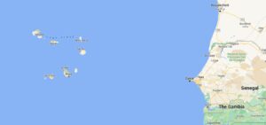
End of November the eruption of the Pico do Fogo on Cape Verde destroyed people´s homes and possessions in the Chã das Caldeiras:
ECDM_20141210_CapeVerde_Volcano
That was nature. And humans? Their extraordinary talent for both creation and for destruction (especially themselves) is evident everywhere. I don´t know how much is still there of what you can see here from Syria or Yemen.
07
2014Cabo Verde: Sal, Santo Antao, Sao Vicente, Santiago, Fogo
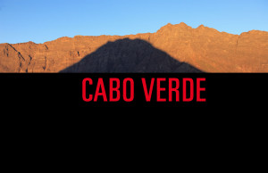
This trip to Cabo Verde was over the turn of the year 2013/2014. Fantastic landscapes, people and music. Every island is unique, the photos here were taken on the islands of Sal, Santo Antao, Sao Vicente, Santiago and Fogo.
I experienced New Year´s Eve in Mindelo on Sao Vicente, people were continuously dancing long into New Year´s Day.
Look at the view from the Pico do Fogo down into Cha das Calderas. Almost one year later everything was different there, the villages of Portela and Bangaeira destroyed by lava.
A few pictures you can also find within Lifestyle, Landscape and People.
05
2014Travelling to Russia
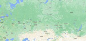
These are just a few impression from the world´s largest country. I have been a few times to Russia, of course much to little to even get an idea of its size, people, culture and nature.
The pictures here are from Moscow and Saint Petersburg, from Irkutsk and Lake Baikal, and from Ulan Ude. While visiting Lake Baikal I stayed overnight at Olkhon Island, a beautiful island full of flowers. Lake Baikal is an unique tranquil place, if you go there, sit on the shore and just watch and relax. Some day I must visit it in winter. One each of the pictures of this series you can also find in People and Plant Life.
I have also been to Russia´s most northern point, the uninhabited Franz Josef Land, located in the Arctic´s eternal ice. Photos from there I will post at some later time. Just one picture taken there you can already see in Animals.
28
2014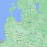 Baltic States 2011
In 2011 I travelled to the Baltic States. The pictures shown here were taken first in Tallinn in Estonia, then in Riga in Latvia and nearby Rundale Palace close to Bauska, and finally in Lithuania´s capital Vilnius. The trip was done in early spring, the weather was perfect, travelling was easy and relaxed. If you like artistic atmosphere and want to visit one maybe more country then you have to go to the Republik Užupis, which you can find within Vilnius.
Some impressions you can also find in the photo series People, Lifestyle, Cities and Cats.
